
Nitro ZIP Coverage Confirmed
Official USPS research confirmed one Nitro ZIP code: 25143. That result establishes the Nitro postal delivery label and its post office, but it does not define the incorporated city line. No official address-by-address USPS boundary list, PO-box-only subarea, unique institutional code, or second code serving a city-limit parcel was located. The Nitro ZIP code directory therefore reports the verified fact and marks the remaining boundary questions instead of filling them with third-party estimates.
| ZIP Code | Areas Covered | Post Office | Notes |
|---|---|---|---|
| 25143 | Nitro postal delivery area; exact official boundary detail was not published in inspected sources | Nitro Post Office, 311 21st Street, Nitro, WV 25143-9998 | Serves a city split between Kanawha and Putnam counties; county cannot be inferred from ZIP alone |
The post office lists general delivery and online PO Box service. Retail hours are Monday through Friday, 8:15 a.m. to 12:30 p.m. and 1:30 to 4:15 p.m., plus Saturday 10 a.m. to noon. PO-box access has a different schedule. Call 304-755-0731 before relying on hours for an in-person task.
The official Nitro Post Office result is shown below.
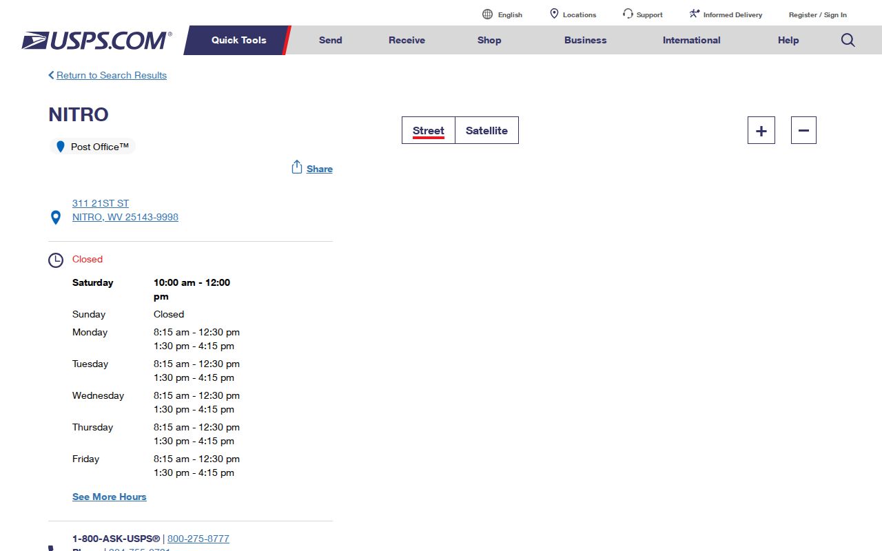
This source confirms the station, service details, and postal code without claiming that the ZIP boundary equals Nitro's legal boundary.
Nitro ZIP Crosses Record Systems
Nitro lies in both Kanawha and Putnam counties along the Kanawha River. The Kanawha planning material describes a small Putnam portion, and Census boundary-change files record Nitro changes in 2000 and 2012. Those entries are useful historic clues, but they are not substitutes for a current parcel map or legal boundary record.
A 25143 label can therefore route mail correctly while leaving the county question open. County determines which clerk holds a deed or local filing. Tax district and parcel ID help distinguish two similar street addresses. For every ZIP code lookup, save the complete USPS result, then use the state parcel viewer to confirm the county polygon and property detail.
Boundary rule. Never assign a Nitro record to Kanawha or Putnam County from the postal city and ZIP alone.
Verify a Nitro Postal Address
The USPS ZIP lookup accepts either a full street address or a city and state. Use the street route when identifying one property. It can standardize the delivery line and ZIP+4, which helps resolve spelling, street suffixes, and directional forms before a tax search.
- Enter the complete street number, street name, city, and state in the official USPS lookup.
- Copy the standardized delivery address and full ZIP result exactly as returned.
- Search the state tax index by ZIP, then narrow with street number, street name, owner, or parcel.
- Open the property detail and record county, district, parcel ID, physical address, mailing address, and legal description separately.
- Use the county and parcel data, not the ZIP, to choose the correct clerk and recorded instrument.
This path narrows a large public index without turning a postal code into proof of city residence. Once a result reaches a named street, the Nitro street directory provides the address-first workflow.
Find Nitro Residents by ZIP
The statewide IAS real-property search is the documented ZIP-capable property route. It combines ZIP Code with tax year, jurisdiction, parcel address number, street, owner name, book, and page. Start broad only when the goal is to survey the postal area. For one person or parcel, add a name or street field as soon as possible.
| IAS field | How it narrows a Nitro ZIP search | Caution |
|---|---|---|
| ZIP Code | Limits results to a postal value such as 25143 | Does not establish city limits or county |
| Jurisdiction and tax year | Selects the assessment system and dated roll | Confirm the county side independently |
| Parcel Address # and Street | Moves from ZIP scale to one road or property | Test abbreviations and directionals |
| Owner Name | Checks a known person or entity within the filter | Tax owner may not be the occupant |
| Book and Page | Connects the result to a recorded deed reference | The clerk supplies the authoritative instrument |
| Sort, direction, results/page | Makes a larger result set easier to review | Save search terms and inspection date |
The captured IAS form below shows the ZIP field in the same search surface as address and deed keys.
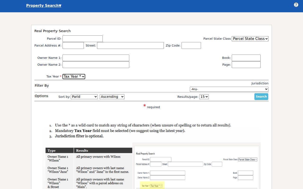
The Kanawha legacy assessor has no separate ZIP field. Search it by parcel address, owner, account, district, map and parcel, legal description, or deed book and page.
Nitro ZIP to Parcel Match
The WV assessment search adds county, district, full parcel ID, owner, street, mailing address, legal description, values, sales dates, flood class, and deed book/page. It does not expose a separate ZIP field in the captured form. Use IAS for the first ZIP cut, then transfer the street, county, and parcel into this richer detail search.
The ZIP-adjacent assessment screen shows why the second pass is needed.
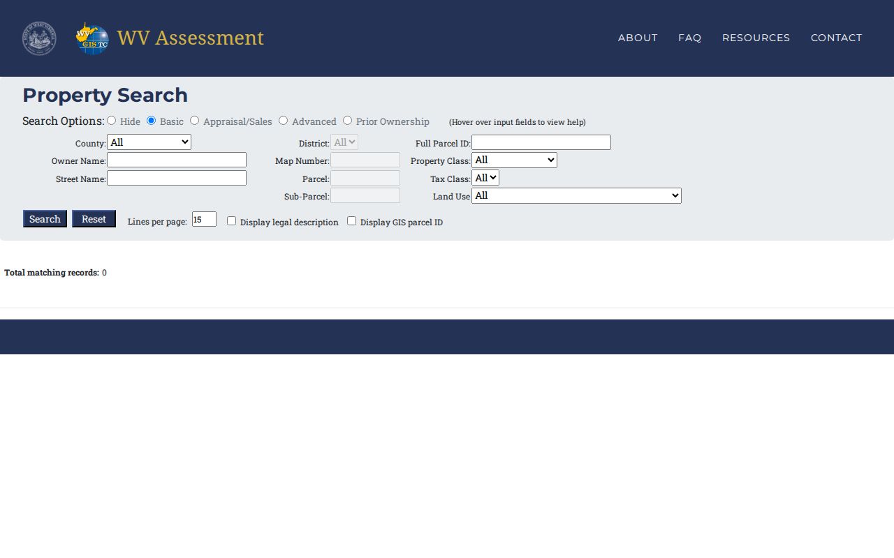
A result may show a physical situs and a separate mailing address. The situs is where the parcel sits. The mailing address is where tax notices go. Neither label by itself proves who lives at the property.
Note: Keep a ZIP-wide result set tied to its tax year because ownership and assessment data change.
Separate Nitro Address Fields
A ZIP search becomes reliable only after each kind of address is labeled. The parcel's situs is its physical location. The owner mailing address is the destination for tax notices and may be in another city or belong to a trustee, agent, or company. The postal city and ZIP describe mail delivery. County and tax district control the local assessment and clerk route. A legal description identifies the lot or tract even if the street label changes.
The Kanawha legacy property form lets a researcher combine Parcel Address with District, Map/Parcel, Legal Description, and Deed Book/Page. Its owner field has a local quirk: enter the name as LAST NAME FIRST NAME with no comma. If a ZIP-filtered IAS hit gives a likely owner, transfer that name in the required order and add the street or parcel key. This second search can distinguish a real Nitro parcel from a same-name record elsewhere in the postal area.
| Address field | Question it answers | Best source |
|---|---|---|
| Postal city and ZIP | How USPS routes the delivery address | USPS address lookup |
| Situs address | Where the assessed parcel physically lies | Assessor or parcel detail |
| Mailing address | Where the owner receives tax mail | Assessment detail |
| County and district | Which local roll and clerk serve the parcel | WV Property Viewer and assessor |
| Parcel ID and legal description | Which exact tract survives spelling or street changes | Parcel card and recorded deed |
When records conflict, compare the date attached to each one. A current USPS standardization, an assessment for a named tax year, and an older recorded deed can all be accurate for their own purposes. Do not overwrite one with another. Preserve the source, date checked, and exact field label. Then ask the Kanawha County Record Room or Putnam County Clerk to verify the recorded instrument tied to the parcel.
Compare Nitro ZIP and ZCTA
USPS ZIP codes route mail. Census ZIP Code Tabulation Areas, or ZCTAs, are statistical shapes built to approximate ZIP geography. Census TIGERweb and the Boundary and Annexation Survey maps can place a postal-style area beside a municipal boundary, but the inspected sources did not yield a Nitro-specific official diagram detailed enough to list each mismatch.
Census QuickFacts reports city figures, not 25143 figures. Nitro's 2020 population was 6,624, with a 2025 estimate of 6,270, but those counts must not be presented as ZIP population. Voter data is organized by person, district, and precinct under state law, not as an open ZIP resident directory. These differences matter whenever a searcher tries to convert a geography into a list of people.
Nitro ZIP Directory Terms
Postal and census labels are easy to mix. These terms keep a Nitro ZIP code directory search precise.
- ZIP code
- A five-digit USPS routing area. It is not a city or county boundary.
- ZIP+4
- The five-digit code plus four digits that narrow delivery to a smaller segment, route, building, or group.
- PO-box ZIP
- A code or delivery pattern used for post-office boxes. No separate Nitro PO-box-only code was verified.
- Unique ZIP
- A code assigned to one high-volume organization. No unique Nitro code was verified.
- Carrier route
- A delivery path served by one postal carrier. It may cross the lines used by other public records.
- ZCTA
- A Census statistical area that approximates ZIP geography for published data.
When an official source does not publish the boundary or special ZIP type, leave it unclaimed. A verified gap is more useful than a polished but unsupported map.
Nitro ZIP Versus City Limits
A postal city can extend beyond an incorporated line, while a city parcel can sometimes carry a nearby postal label. For Nitro, the two-county split makes that mismatch especially important. USPS answers delivery questions. The West Virginia parcel map answers county, district, and parcel questions. A clerk's recorded deed answers title questions.
Make a five-column worksheet for each uncertain address: standardized USPS address, postal city and ZIP, physical situs, county and tax district, and parcel/legal description. If the fields disagree, do not force them into one label. Check TIGERweb or a BAS map for geographic context, then ask the relevant county GIS, assessor, planning office, or clerk to confirm the authoritative field.
No official Nitro ZIP split or realignment year was located. Council material mentions Wilson Avenue abandonment and an Interstate 64 annexation discussion, but those clues cannot prove a postal change. The Nitro ZIP code directory should remain tied to current official lookups rather than local memory or commercial maps.